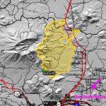
This is a map of the current perimeter of the Schultz Fire (6/23/10). I borrowed it from a federal interagency website. Yellow is the burn area, the crater to the left of the burn area is the "Inner Basin" of the San Francisco Peaks. Notice our Studio/House in the bottom right. The fire is nearing a couple of our favorite spots, Lockett Meadow … [Read more...]
You are here: Home / Archives for map
